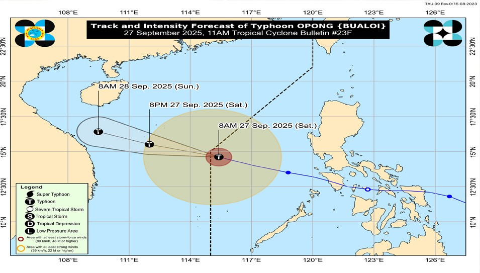

Typhoon “Opong” has left the Philippine Area of Responsibility (PAR) as of Friday morning, September 27, but continues to enhance the Southwest Monsoon, the Philippine Atmospheric, Geophysical and Astronomical Services Administration (PAGASA) said on Saturday.
In its 11:00 AM (#23F) bulletin, PAGASA reported the eye of the typhoon was located 645 kilometers west of Sangley Point, Cavite.
It is moving west-northwestward at 35 km/h towards northern Vietnam, where it is forecast to intensify further.
While all tropical cyclone wind signals have been lifted, the enhanced habagat (Southwest Monsoon) remains the primary hazard which may bring severe conditions to parts of the country throughout the day.
Strong to gale-force winds are still expected today over Luzon, Western Visayas, and Negros Occidental, particularly in coastal and upland areas exposed to the elements.
Seafarers of small seacrafts, including all motorbancas, are advised not to venture out due to rough seas which may rise up to 3.5 meters, affecting the areas of Batanes, Babuyan Islands, Zambales, and Northern Palawan.
Opong’s departure brings a close to its direct impact on the country, which included multiple landfalls and resulted in casualties and significant damage.
PAGASA advised the public especially those in western sections of the country to remain cautious of the ongoing effects of the enhanced monsoon. — Marlon Magtira
